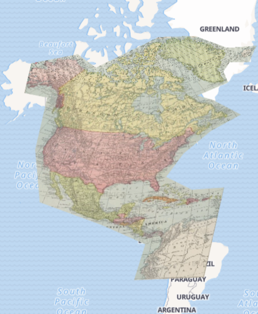
With the help of David Rumsey Georeferencer, I mapped Commercial Atlas of America. Rand McNally, 14 x 21 Inch Map of North America published in 1924 to a digital Mercator projection map of the world.
Did this process change your understanding of the spatial DH projects you explored earlier?
The process of projecting a historic map to current world map consolidates my understanding of spatial DH projects. Spatial DH projects are presented to the public in order to inspire empathy. Thinking of living in the same place where important historical figures were born and died and/or turning points of history took place, people will generate a great sense of sorrow, happiness, pride, and etc.
Examine the This Map page, what formats can you access the map you rectified in?
With This Map page, I can rectify this map to fit in ArcGIS, QGIS or web apps with web map services. Also, I can export it to GeoTIFF, a public domain metadata standard which allows georeferencing information to be embedded within a TIFF file.
What possibilities do you see once you have a georectified map? What would be next steps?
For this map, we can compare the past North America to the present one(which has little difference in geological sense). For maps drawn by people long ago in history, by rectifying the map created based on current world map, it helps a lot with archeology in that finding the location to dig would be much easier.
Are there problems with georeferencing that you should consider?
This map, for example, does not match very well even when I put many corresponding points on the same longitudes and latitudes. This may be because one of them is drawn in a 2D sense while the other drawn in a 3D sense with natural bending.
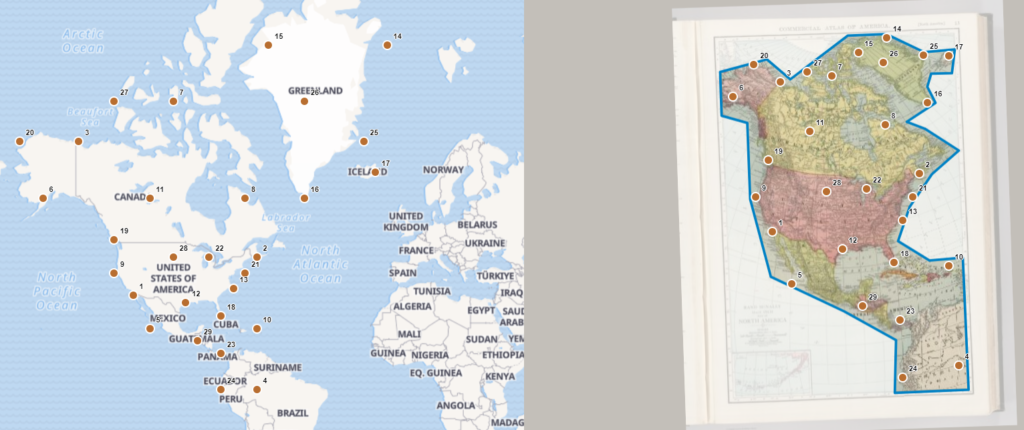
Another problem to consider is that when dealing with maps not so close to our times, there are no longitudes and latitudes, and it would be difficult to pinpoint the same location on such maps and current world map.
What research questions or areas would this method NOT be appropriate for?
This method is useful in spatial DH projects, but when it goes out of this field, it may not be that appropriate.