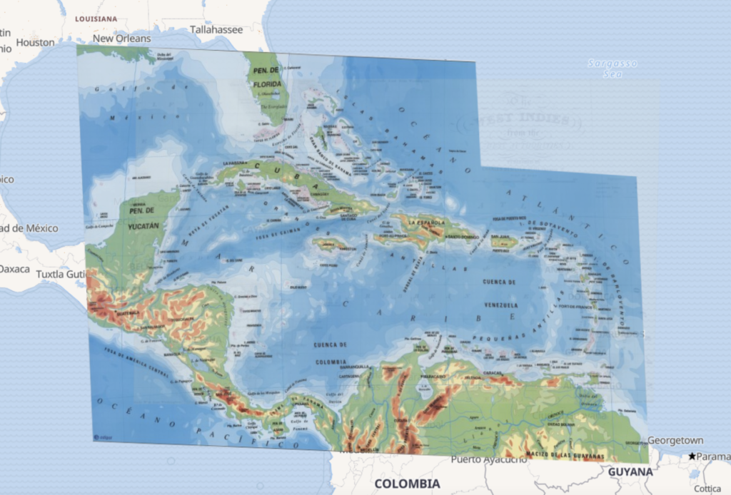
This week, I used the Georeferencer tool on the David Rumsey Map Collection Project to overlay and compare historical maps of the Caribbean islands with a modern map. This process involved finding a map that was similar in shape to the modern depiction of the islands and picking reference points to properly orient the overlayed maps.
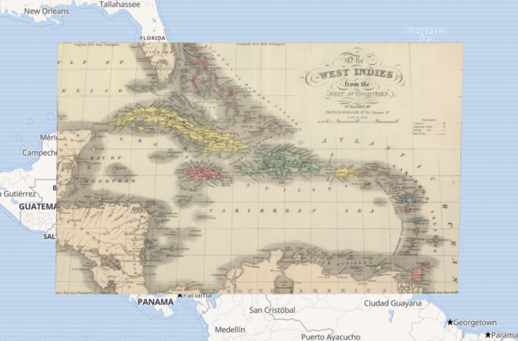
My understanding of spatial DH projects has certainly been changed by this process. I now appreciate the amount of work and attention to detail that goes into georectifying a map. It requires a deep understanding of both the historical map and the current geographic coordinate system, as well as the ability to manipulate and adjust both in order to achieve the correct alignment. This process also requires a keen eye for detail and the ability to identify and correct any inaccuracies or distortions in the historical map.

Once you have a georectified map, the possibilities are endless. You can use the map for a wide range of spatial analysis and mapping projects, including demographic and economic analysis, environmental studies, and historical research. The next steps would be to add additional data to the map, such as demographic data or historical events, to gain a deeper understanding of the area and its evolution over time.

There are a few problems with georeferencing that you should consider. One of the biggest challenges is ensuring that the historical map is accurate and free from distortions. It is also important to make sure that the map is correctly aligned with the current geographic coordinate system and that all relevant data is included in the final product.
This method may not be appropriate for certain research questions or areas, particularly if the historical map is not accurate or if the geographic information is not relevant to the research. Additionally, georectifying may not be the best method for areas with complex geography or irregular boundaries, such as coastlines or mountain ranges.